Almanac
Point forecasts from three models, redrawn through the day.
Each place is drawn once with all models together — MET Norway, ICON · DWD and ECMWF IFS — and once per model. Updated 29 Oct 2026, 23:35 UTC.
Lomsdal-Visten
The route: the towns on the way in, then the line from the northern start to the southern endpoint, cut into sections small enough for one comparison chart.
Entrance
The towns on the way in, south to north. Far apart and far from the route, so this map is drawn at a much smaller scale than the others. Four is the most a comparison draws, so this section is now full.
Drawn 29 Oct 2026, 23:35 UTC
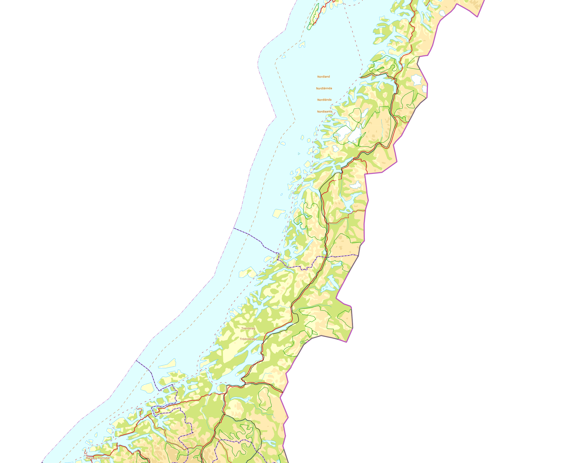

Trondheim
63.431°N 10.395°E·10 m·City on the Trondheimsfjord, on the way in
Drawn 29 Oct 2026, 23:35 UTC

Single models — MET Norway, ICON · DWD, ECMWF IFS


Mosjøen
65.838°N 13.189°E·10 m·Town at the head of the Vefsnfjord, nearest the northern start
Drawn 29 Oct 2026, 23:35 UTC

Single models — MET Norway, ICON · DWD, ECMWF IFS


Mo i Rana
66.311°N 14.139°E·13 m·Town on the Ranfjord, between Trondheim and Bodø; 13.1 m per Kartverket dtm1
Drawn 29 Oct 2026, 23:35 UTC

Single models — MET Norway, ICON · DWD, ECMWF IFS


Bodø
67.284°N 14.382°E·9 m·Town at the northern end of the way in, and the crossing to Lofoten; 8.9 m per Kartverket dtm1
Drawn 29 Oct 2026, 23:35 UTC

Single models — MET Norway, ICON · DWD, ECMWF IFS


Northern section
Northern start, the pass west of it, mountain proxy and quay, in the stated route sequence.
Drawn 29 Oct 2026, 23:35 UTC
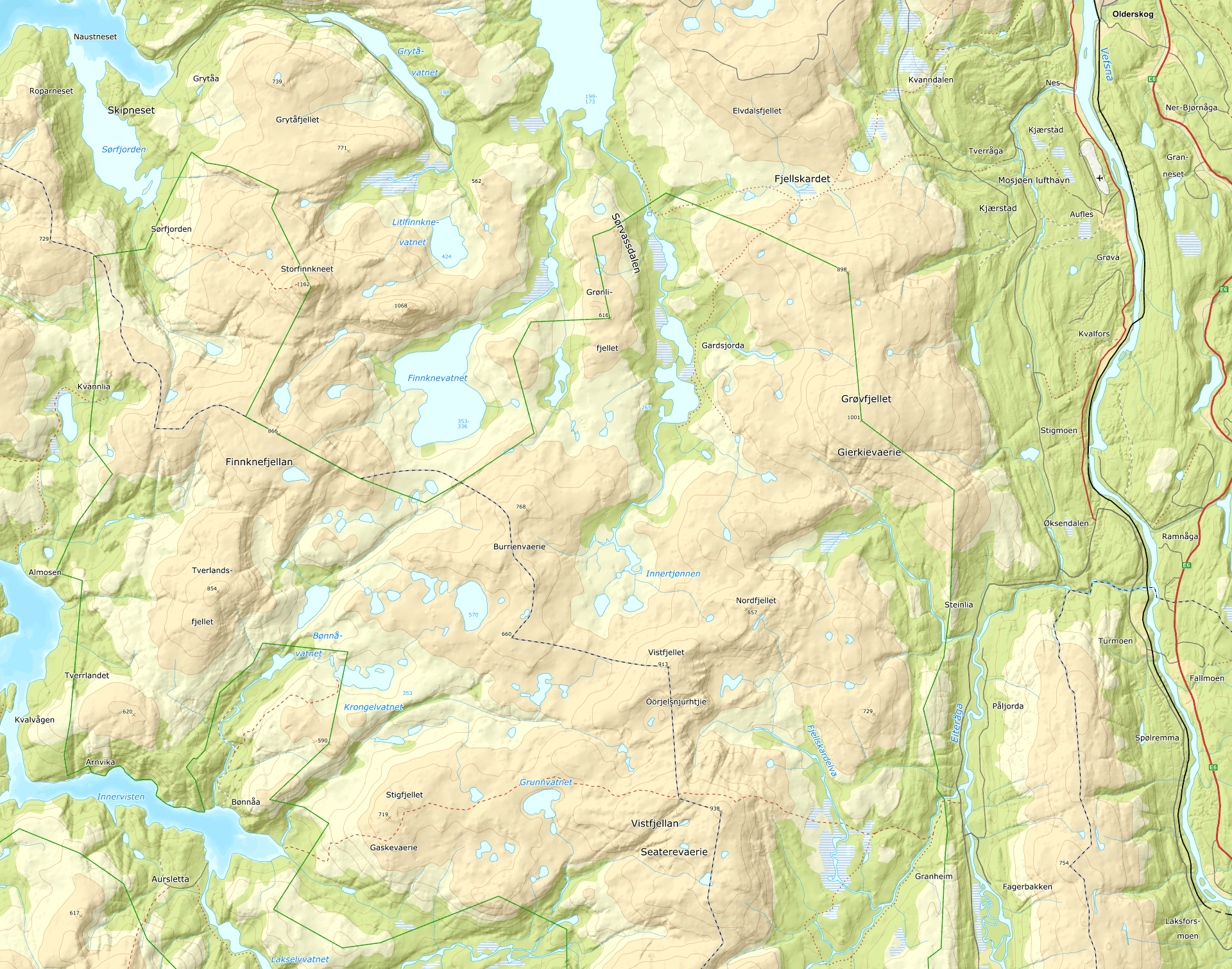

Tverrådalen
65.785°N 13.171°E·66 m·Valley floor at the northern start; forest, per Kartverket dtm1
Drawn 29 Oct 2026, 23:35 UTC

Single models — MET Norway, ICON · DWD, ECMWF IFS


Fjellskardet
65.776°N 13.066°E·505 m·Pass west of Tverrådalen; open ground, 504.7 m per Kartverket dtm1
Drawn 29 Oct 2026, 23:35 UTC

Single models — MET Norway, ICON · DWD, ECMWF IFS


Burrienvaerie
65.700°N 12.903°E·764 m·Mountain name-point used as a high-terrain proxy
Drawn 29 Oct 2026, 23:35 UTC

Single models — MET Norway, ICON · DWD, ECMWF IFS


Bønå hurtigbåtkai
65.645°N 12.754°E·Fast-boat quay
Drawn 29 Oct 2026, 23:35 UTC

Single models — MET Norway, ICON · DWD, ECMWF IFS


Central section 1
Fjord head, the mountain above it and the lake beyond, west to east.
Drawn 29 Oct 2026, 23:35 UTC
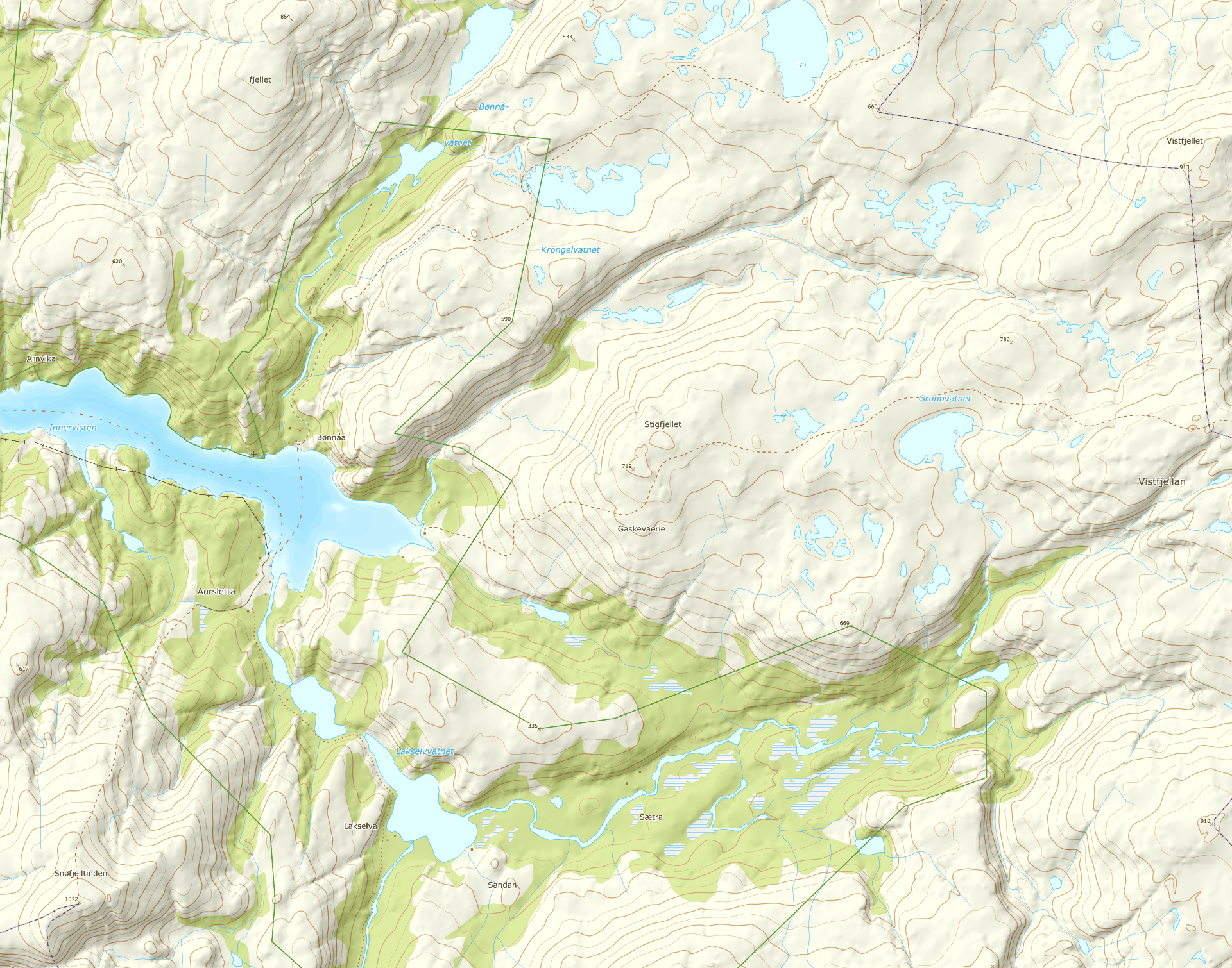

Austerfjorden
65.635°N 12.786°E·2 m·Fjord head at sea level; open ground, 1.3 m per Kartverket dtm1
Drawn 29 Oct 2026, 23:35 UTC

Single models — MET Norway, ICON · DWD, ECMWF IFS


Stigfjellet
65.641°N 12.849°E·680 m·High mountain point east of Bønå; open ground, 678.6 m per Kartverket dtm1
Drawn 29 Oct 2026, 23:35 UTC

Single models — MET Norway, ICON · DWD, ECMWF IFS


Grunnvatnet
65.646°N 12.889°E·613 m·Lake point between Stigfjellet and Vistfjellan; open ground, 609.9 m per Kartverket dtm1
Drawn 29 Oct 2026, 23:35 UTC

Single models — MET Norway, ICON · DWD, ECMWF IFS


Central section 2
The high point of the line and the descent east of it. Split from section 1 here because the 4.7 km between Grunnvatnet and Vistfjellan is the widest gap in the row, and a comparison draws at most four places.
Drawn 29 Oct 2026, 23:35 UTC
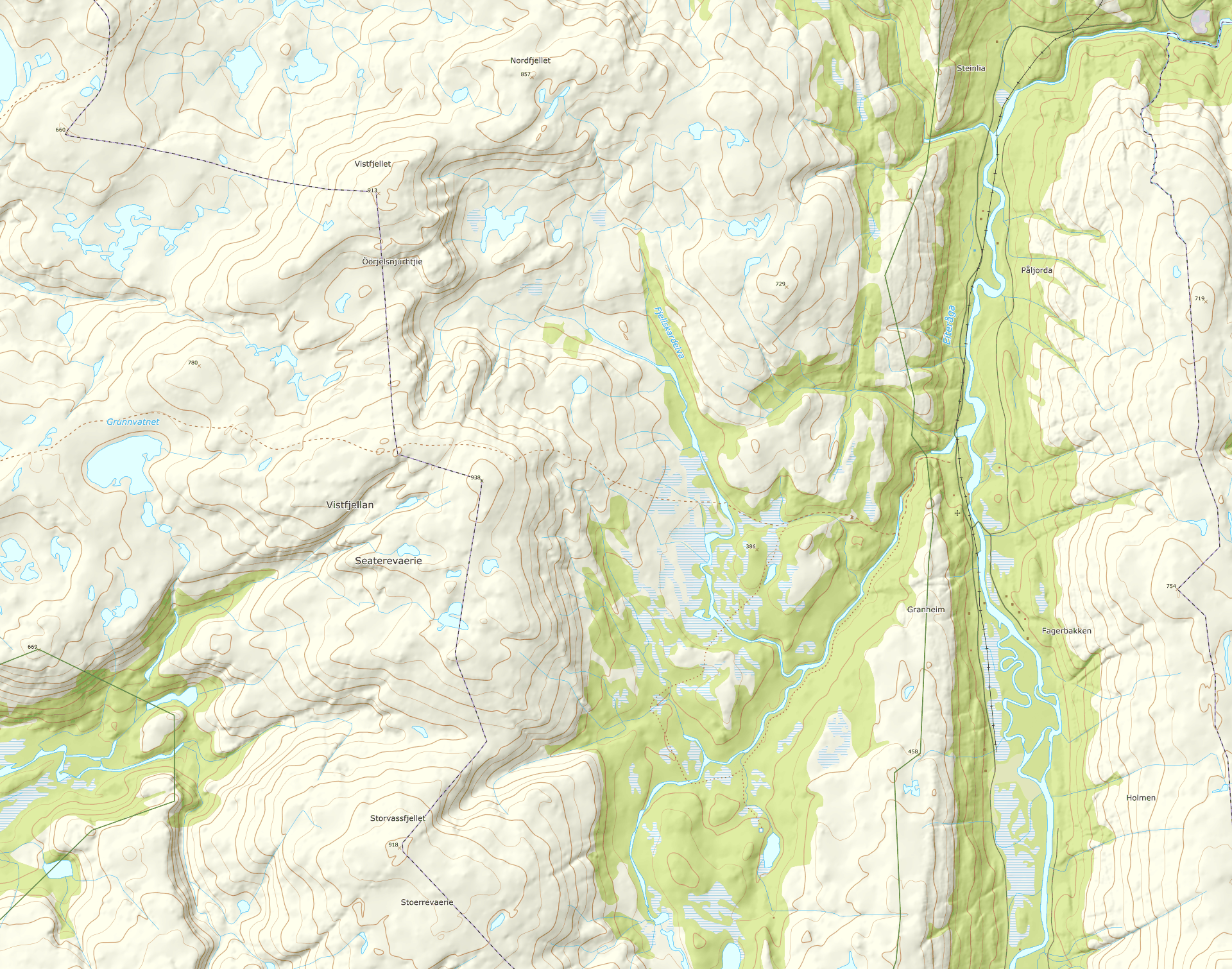

Vistfjellan
65.647°N 12.991°E·903 m·The high point of the central line; open ground, 903.0 m per Kartverket dtm1. Not Visttindan, which is 11 km south
Drawn 29 Oct 2026, 23:35 UTC

Single models — MET Norway, ICON · DWD, ECMWF IFS


Eiteråfjellet
65.640°N 13.116°E·325 m·Open ground at 323.5 m per Kartverket dtm1; a given coordinate, no longer a name-point proxy
Drawn 29 Oct 2026, 23:35 UTC

Single models — MET Norway, ICON · DWD, ECMWF IFS


Central section 3
Visttindan and the Lomsdalen valley point, south of the others.
Drawn 29 Oct 2026, 23:35 UTC
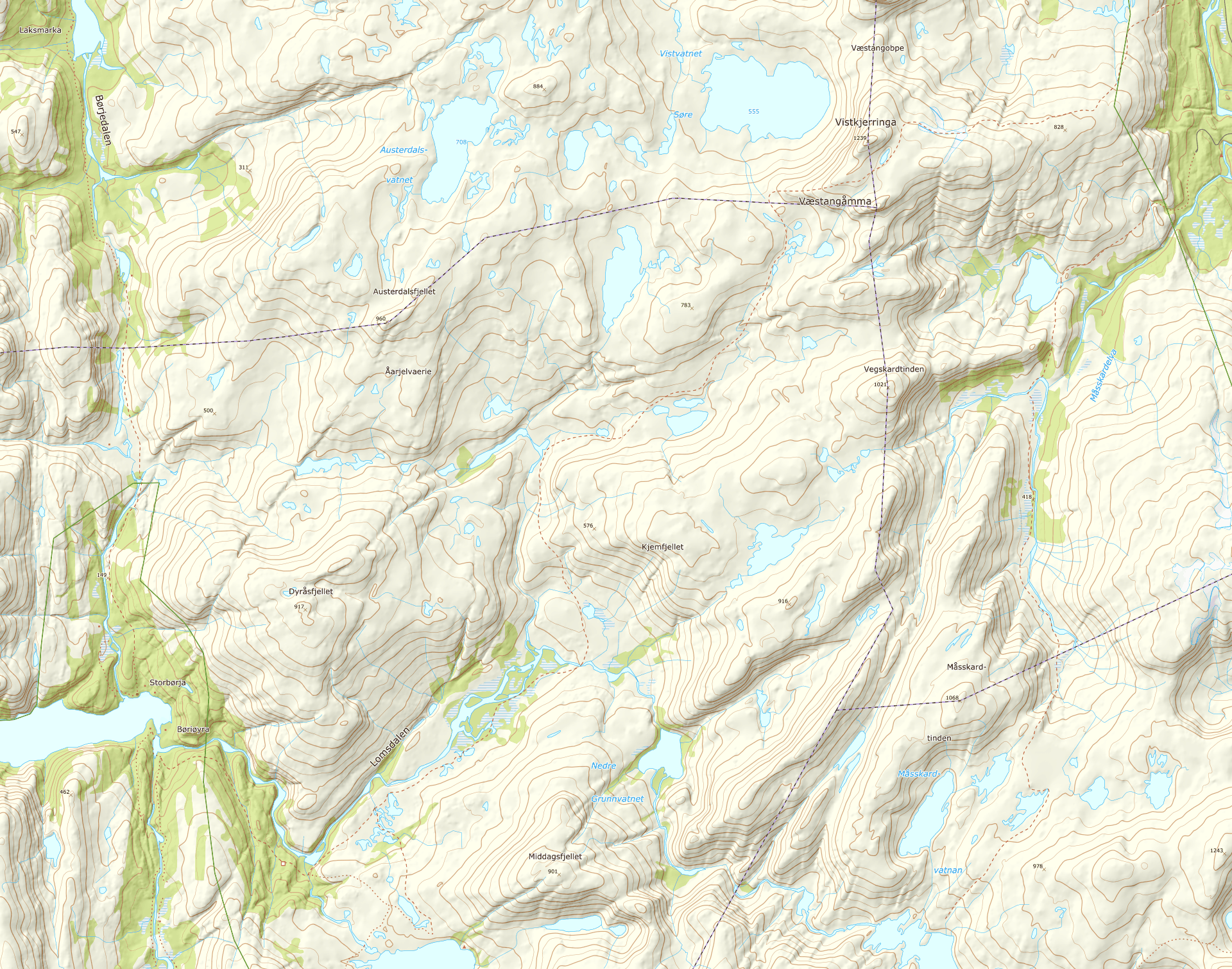

Visttindan
65.546°N 13.044°E·1087 m·High-elevation stress-test proxy; not assumed to lie on the track
Drawn 29 Oct 2026, 23:35 UTC

Single models — MET Norway, ICON · DWD, ECMWF IFS


Lomsdalen
65.450°N 12.841°E·200 m·Interior valley point
Drawn 29 Oct 2026, 23:35 UTC

Single models — MET Norway, ICON · DWD, ECMWF IFS


Southern section
Lower and higher Breivatnet points followed by the southern endpoint.
Drawn 29 Oct 2026, 23:35 UTC
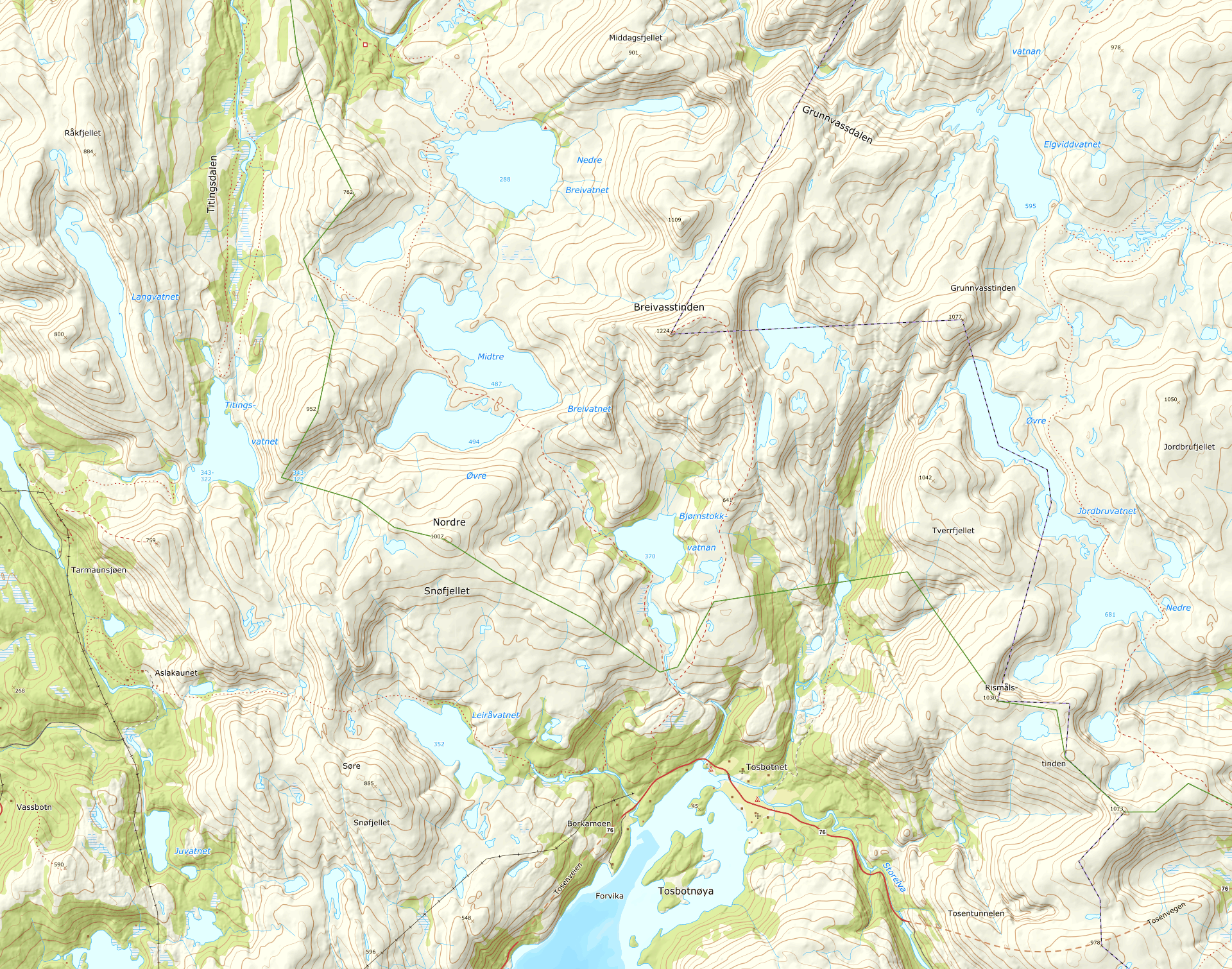

Nedre Breivatnet
65.424°N 12.875°E·286 m·Optional lower-lake point for the descent and river section
Drawn 29 Oct 2026, 23:35 UTC

Single models — MET Norway, ICON · DWD, ECMWF IFS


Midtre Breivatnet
65.394°N 12.868°E·487 m·Higher Breivatnet lake point
Drawn 29 Oct 2026, 23:35 UTC

Single models — MET Norway, ICON · DWD, ECMWF IFS


Tosbotnet
65.326°N 12.958°E·6 m·Low-elevation southern endpoint
Drawn 29 Oct 2026, 23:35 UTC

Single models — MET Norway, ICON · DWD, ECMWF IFS


Eastern section
Stavassgården and the plateau south-west of it, east of the Breivatnet points and at much the same latitude.
Drawn 29 Oct 2026, 23:35 UTC
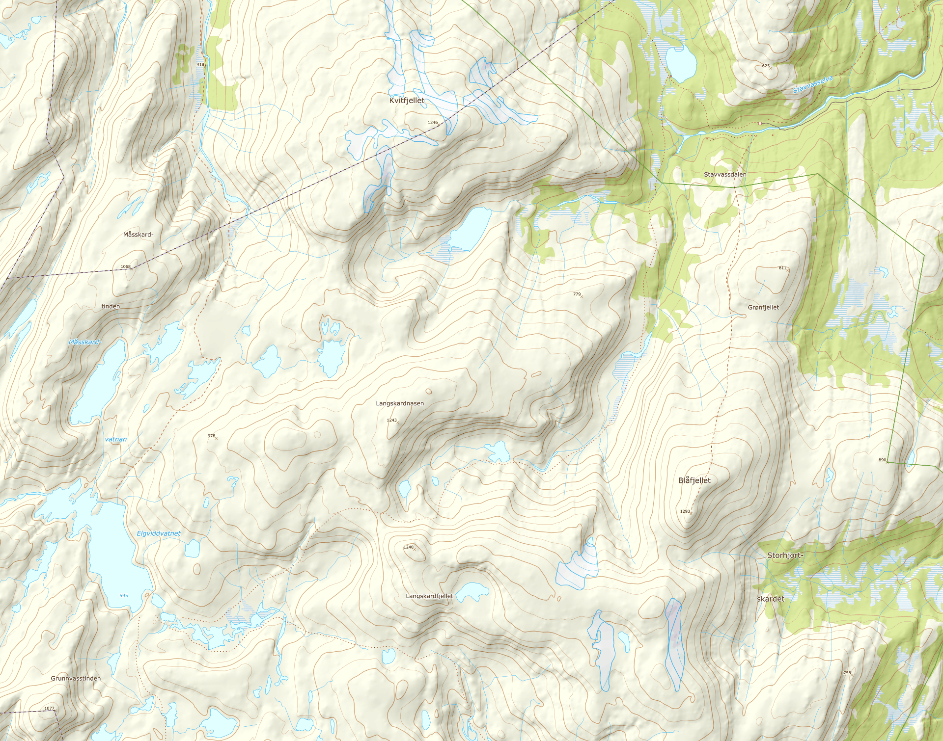

Stavassgården
65.487°N 13.292°E·269 m·Tourist cabin in Stavvassdalen, so registered by Kartverket; 269.2 m, open ground
Drawn 29 Oct 2026, 23:35 UTC

Single models — MET Norway, ICON · DWD, ECMWF IFS


Elgviddevatnet
65.414°N 13.085°E·626 m·625.7 m on open ground. Kartverket has no name here; the nearest is the plateau Sarvejællan Åarjelguevtele, 'sarve' being South Sámi for elk
Drawn 29 Oct 2026, 23:35 UTC

Single models — MET Norway, ICON · DWD, ECMWF IFS


Lofoten
Not the route: Reine on Moskenesøya and the mountain above it, 250 km north.
Drawn 29 Oct 2026, 23:35 UTC
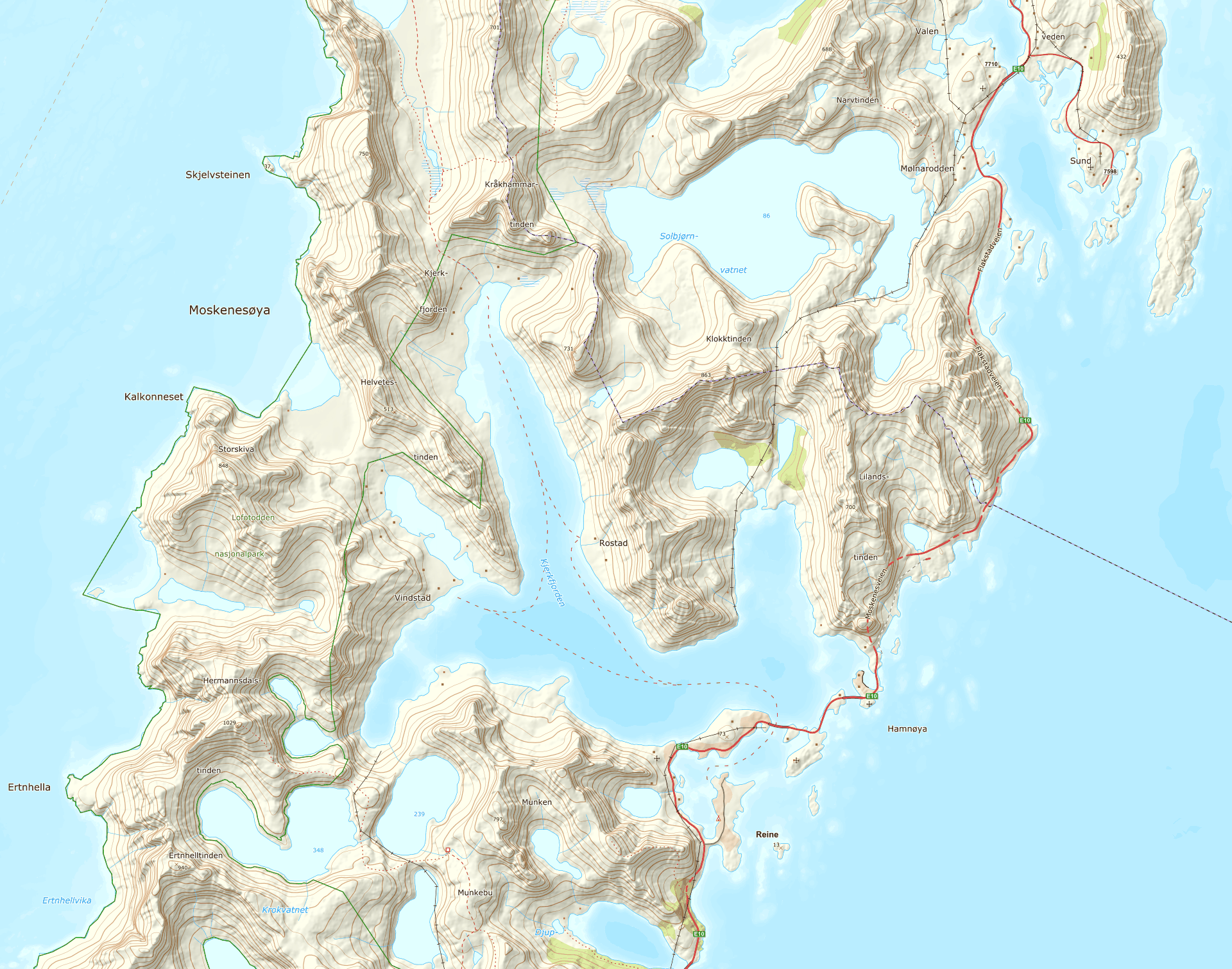

Reine
67.933°N 13.089°E·12 m·The village on Moskenesøya; 12.2 m per Kartverket dtm1
Drawn 29 Oct 2026, 23:35 UTC

Single models — MET Norway, ICON · DWD, ECMWF IFS


Markan
68.008°N 13.023°E·396 m·Mountain in Lofotodden nasjonalpark, 8 km north of Reine; 396.3 m, open ground
Drawn 29 Oct 2026, 23:35 UTC

Single models — MET Norway, ICON · DWD, ECMWF IFS


Abisko
Not the route: a few days in Swedish Lapland, 400 km north-east. Two Malmbanan halts, two STF cabins and four points above the treeline. No locator map: Kartverket draws nothing over Sweden.
Halts and cabins
Two Malmbanan stops and two STF cabins, 390 to 700 m — where the days start and end.
Drawn 29 Oct 2026, 23:35 UTC

Björkliden station
68.406°N 18.686°E·425 m·Malmbanan halt above Torneträsk; the northern way in. 425 m per Open-Meteo's 90 m DEM, 434 m per Mapzen
Drawn 29 Oct 2026, 23:35 UTC

Single models — MET Norway, ICON · DWD, ECMWF IFS


Abisko Östra station
68.349°N 18.829°E·390 m·The village halt, one stop before Abisko Turiststation. 390 m per DEM against OpenStreetMap's surveyed 388 m
Drawn 29 Oct 2026, 23:35 UTC

Single models — MET Norway, ICON · DWD, ECMWF IFS


STF Kårsavagge fjällstuga
68.335°N 18.501°E·700 m·Cabin in the Kårsavagge valley, the highest of the four. 700 m per DEM, 713 m per Mapzen; no surveyed figure
Drawn 29 Oct 2026, 23:35 UTC

Single models — MET Norway, ICON · DWD, ECMWF IFS


STF Abiskojaure fjällstuga
68.286°N 18.591°E·490 m·Cabin at Ábeskojávri on the Kungsleden, south of the others. 490 m per DEM and per OpenStreetMap alike
Drawn 29 Oct 2026, 23:35 UTC

Single models — MET Norway, ICON · DWD, ECMWF IFS


Above the treeline
Låktatjåkko, Kåppatjåkka and Njulla run west to east a little over a kilometre up; the pass to Abiskojaure sits 6 km south at much the same height. Their own section because that height is the whole difference from the halts.
Drawn 29 Oct 2026, 23:35 UTC

Låktatjåkko fjällstation
68.399°N 18.461°E·1226 m·Mountain station on the plateau west of Björkliden, 1226 m; Open-Meteo's 90 m DEM says 1223 m
Drawn 29 Oct 2026, 23:35 UTC

Single models — MET Norway, ICON · DWD, ECMWF IFS


Kåppatjåkka
68.373°N 18.544°E·1164 m·The middle of the three tops, between Låktatjåkko and Njulla, 1164 m; the 90 m DEM smooths a summit and says 1155 m
Drawn 29 Oct 2026, 23:35 UTC

Single models — MET Norway, ICON · DWD, ECMWF IFS


Pass to Abiskojaure
68.316°N 18.554°E·1138 m·The crest of the direct crossing between the two cabins, 3.0 km from one and 3.6 from the other. No name in OpenStreetMap; the 90 m DEM says 1131 m
Drawn 29 Oct 2026, 23:35 UTC

Single models — MET Norway, ICON · DWD, ECMWF IFS


Njulla
68.373°N 18.699°E·1164 m·The top south of Abisko Östra, 1164 m; the 90 m DEM smooths a summit downwards and says 1146 m
Drawn 29 Oct 2026, 23:35 UTC

Single models — MET Norway, ICON · DWD, ECMWF IFS


